Sunday, April 27, 2008

Ride For Kids

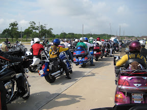
Once a year a bunch of motorcycle riders in the Houston area get together and take a little ride to raise money for medical research centering on brain tumors that occur in children. This event is called the "Ride for Kids" and it benefits the Pediatric Brain Tumor Foundation. (See links on right side bar)

We all pay about $35 to ride a 40 mile parade where the local police close whatever roads we are scheduled to ride (including interstates) and we putt down the road. But the work is done well before the day of the ride. All year, we have groups of bikers raising money for the effort and this year the Houston area riders raised over $280,000. These events happen all over the country and combined they add up to a tidy sum funding research that has had real results.

Years ago, it was common for a child with a tumor to pass away in the time between one fund raising ride and the next, but today we heard from a 31 year old nurse who was one of the early brain tumor survivors. The youngest patient we heard from today was 13 months old. She didn’t have much to say, but her father spoke for her and expressed the hope that he had for her future.

We bikers can't take credit for the advances that have occurred over the past 25 years that the Pediatric Brain Tumor Foundation has been funding research, but it is nice that a bunch of regular folks like us have found a way to be involved in furthering this effort.

My camera ran out of battery before much of the ride was complete today, but it was a good event for a worthy cause. Eighteen survivors and current patients from 13 months to 31 years old took the stage to tell us a little about their cases and thanks to the PBTF and Ride for Kids all of their futures look a little brighter.

Even the rain on the way home couldn't undo the good that came from today's ride.

oVo

Monday, April 21, 2008

Skaggs Spring Road


Skaggs Spring Road (SSR) was cited as "the best bike road in Northern California" by my riding buddy Joe. So without delay, Joe and I headed North today to check it out.

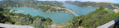
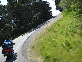
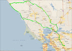
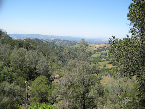
We rode 77 miles to get to Calistoga where the road turned good. Nice and scenic with some sweepers and a few tight twisties. But the main course was still to come and soon enough we turned West on the SSR. It was great. I took a bunch of pics with my left hand while negotiating the sweepers with my right hand on the throttle. I think it can give you an idea of how nice this road is and how much fun the sweepers are. Just after the big bridge I put the camera away because the road narrowed and wound its way through the forest with steep drop offs just over the edge of the pavement. It was no place to be careless so I wasn't.

SSR dumps you out on the PCH at Stewarts Point after a satisfying 45 miles or so of sweepers, hair pins, grand vistas and finally a jungle scene right out of Jurassic Park right before you see the Pacific Ocean. Great road.

The PCH was also a fine ride with views unparalleled. Click on any of the pics here to see the rest of them in the web album.


oVo

Thursday, April 17, 2008

Day hike through Pine Valley on Mt. Diablo

I had several items on my list of fun things to do this week. I was going on a motorcycle ride Monday but the weather turned even colder than normal with night time temps in the 30s and the days warming up slowly. To top it off, the guy I was hoping to ride with had a family emergency and wasn't able to join me so I just filed the map and will do it some other time.

I was also going to take the commuter train into San Francisco to scout for a weekend trip that Brenda and I were planning to take this Saturday. But, although the weather has warmed back up the forecast for the weekend looks cold and windy in the city so we are holding off on the Saturday trip too.

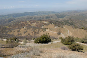
But the one thing that I had not planned to do, but that has been on my list for some time is to take a walk up in Mt Diablo State Park. Mt. Diablo is the biggest thing around here rising 3,849 ft and offering views of things as far away as the Golden Gate Bridge on clear days. One web site says that Mt Diablo provides views of more geographic area than any other peak except Mt Kilimanjaro. Not sure I believe that but there are some nice views. Check it yourself though at this site.

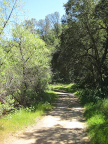
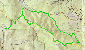
Anyway, last night I pulled out my trail map that I bought a few months back and with the help of the web found a trail route that I thought fit my needs for today. It was a six mile loop with a 1000 ft elevation gain and is rated "strenuous" or "moderate" depending on the website you find it on. For me, it took three hours and I rested about three times during the steepest portions of the climbing sections. Moderate is probably about right.

I picked up the trailhead at Macedo Ranch which has a ranger station at it along with some picnic tables, drinking water and water for horses. The state charges $3 on the honor system to park in their gravel lot so after stuffing an envelope I strapped on my day pack and headed out.

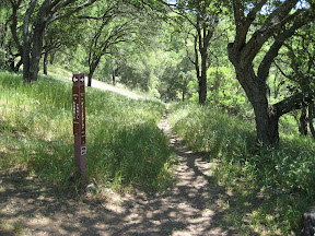
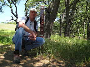
I was a little disappointed initially since the "trail" was actually a dirt road that they use for fire abatement during the dry season. It turns out that most of the trails here are like that. But at the furthest point in my walk today I took a hard right hand turn onto "Secret Trail" and was rewarded with a foot path that gained elevation from 1175 to 1465 ft in about a mile and joins BBQ Terrace Rd with Wall Point Rd.

My walk today provided plenty of rewards besides the clean air and exercise. I saw lots of scenery and plants that I am not used to seeing. I listened to wild turkeys from just over the next ridge and was stopped in my tracks by bees buzzing so loudly that they commanded attention. I even heard that "Eagle screech" sound that all the TV shows use when they want you to know that you are viewing a wilderness program.

Mt. Diablo is far from wilderness and does not even allow back country camping. Normally there is no where to camp in the back country because of the scarcity of water, but today I made three stream crossings and enjoyed touching the icy snow runoff each time.

My route today started at Macedo Ranch and proceeded North by Northeast about 0.87 miles along Wall Point Rd to Dusty Rd, which branches due North (left.) Dusty Rd descends 260 ft in a half mile and intersects with Stage Rd before merging into BBQ Terrace Rd in another 0.45 miles and after ascending a mere 80 ft before splitting from Stage Rd for good. At this point you are at 715 ft with a steady climb to 1175 facing you over the next mile to the intersection of Secret Path. Turning Right (SE) on Secret Path continues the climb over the next mile to 1465 ft where you rejoin Wall Point Rd and climb the remaining 135 ft in just a quarter mile or so before starting your descent with the sheer drop to your left. Look closely and you may spot some interesting erosion patterns in some of the rocks jutting up from the canyon floor 500 feet below. The descent is easy as long as your knees are good. I stopped a few times to rub my worn out hinges. I guess my basketball injury from earlier in the year is not quite healed yet. One and three quarter miles later you intersect Dusty Rd again, only this time you turn hard left (SW) to get back to the trailhead having seen wonderful vistas and no telling what else.

With 20,000 acres and over 100 miles of trails I suspect that Mt Diablo has not seen the last of me... …or me of it.

oVo

Saturday, April 12, 2008

Point Arena Light House

Our mission for today was to get North as fast as we could and then cut over to the Pacific Coast Highway and head South for a nice drive home along the wonderfully scenic PCH. Like all of our California trips so far we were surprised by the scenery, both on the PCH and while getting to it.

We drove Northward diving deep underground through the tunnels through the mountains on HWY 24 and then across the San Francisco Bay on I-580. I was completely surprised to see San Quentin located right on the bay. Man this is some high dollar real estate put to use as a retirement home for criminals. What a view they have. Well, they WOULD have a great view I guess.

We stayed inland and fought the weekend traffic through Novato, Petaluma and Santa Rosa Continuing to stretch our legs ever Northward. Finally after we cleared Santa Rosa, HWY 101 narrowed to four lanes and the traffic thinned out making the driving a little more enjoyable and less like a massive session of "Dodge Car." HWY 101 is scenic enough but I was eager to get off of it and onto some smaller and more interesting roads.

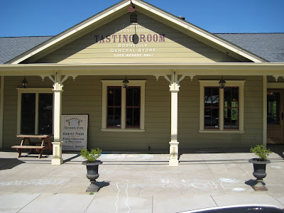
We finally did that at Cloverdale where we veered West by Northwest on Hwy 128. Now that is a great road; two lanes of smooth pavement winding its way toward Booneville where we stopped for an "organic hand made" lunch. Booneville looks to us like sort of a hippy holdover, full of interesting looking people and more cafes and restaurants per capita than anywhere I can recall. Nice town and it is in a good spot in the road for a day trip. Just far enough away to have us wanting a little break.

After lunch we hung a hard left on Mountain View Road where we enjoyed the 30 mile meander over the last mountain range before we hit the coast. Mountain View Road is a beautiful run through a redwood forest and allows speeds less than 30 mph with no penalty. Go faster than that and you are either a really good driver or about to meet a new group of doctors. While still about 8 miles from the coast we broke out of the forest and saw the Pacific Ocean in the distance. Cool.

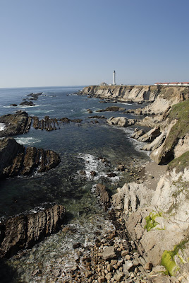
We stopped at the lighthouse and snapped a few pics. I have learned that I have to budget my time at these ocean overlooks because I could really just sit and watch the swells all day. After the photo session we headed South on the PCH and alternately caught spectacular views of the ocean and ducked into the forest as this famous road shared it's multiple personalities with us. At one minute you are at sea level and could walk down to a secluded beach not even seen from the road, and the next moment you are 1000 feet above the surf on a road carved out of the cliff. Top a hill in the forest and ease down into the next glade and the temperature can drop 10 degrees. Now we know what a micro-climate really feels like.

We were in the convertible today but this ride would have been a great bike trip. It was a long day at 330 miles and much of that in the 30 - 35 mph range. Any serious exploring along the PCH North of San Francisco is going to require a multi-day trip but I am absolutely certain that it will be worth it.

Remember, you can click on any of the pics in this post and go directly to my web albums where you can see full size versions and a few that I didn't have room for here.

oVo

Monday, April 07, 2008

Day Ride Toward Reno

I have a lot to learn about planning rides in California. After about an hour of interstate and some two lane highway, which was a small price to pay for getting to the roads I suspected I would find on the way across the Sierra Nevadas, I spotted snow in the approaching mountain peaks. I pressed on figuring that even if I had to turn around, it would still be a good day of riding.

It ended up taking me about 2 hours to clear the interstate and the flatland traffic at Jackson, CA. By this time I had already enjoyed what is becoming a staple of my forays into this scenic state. I had run past the windmills along I-580 in Livermore and had taken in a new set of rolling grass covered hills as the bike and I steadily climbed toward the snow.

In Jackson the changes became more abrupt and the road started winding its way upward via the path of least resistance. Kit Carson first navigated this pass that became a crucial link across the Sierras for the Pony Express. I encountered my first roadside snow at 4500 feet and thought to myself "This won't be so bad." That was before I realized that the road kept climbing to 8000 feet.

I had dressed for temperatures between 50 - 70 degrees F because I left the house at about 10 AM after the chill was out of the air. Normally things warm up around here by about 2 and by 5PM it is in the high 60s or maybe low 70s. Well, in the valleys at least. Up in the passes things are a little different.

When I stopped for lunch, I put on my heavy gloves. The temperature was in the low 50s. At 5000 feet, I checked the temp again and it was in the low 40's. At 6700 feet I had had enough and stopped to put on my jacket and pant liners which are good to the low 30's. Good thing too because when I checked before I re-mounted the bike, it was 36 and it stayed that way for quite some time.

I continued climbing past the signs that declared the area an avalanche hazard and past the swing gates that are permanently installed for the inevitable times when the road must be closed. Dodging just a few ice boulders in the road (rocks really) I eased my way to the top and then down the other side of the pass into the Diamond Valley.

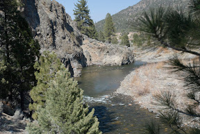
My route called for a right turn on CA 89 which I took, but as I made the turn I saw what I had expected to see ever since first spotting the snow on the distant peaks. The passes back to the other side of the mountain range were closed along HWY 4. I figured I was lucky to get this far and continued down the road a little while until I found a beautiful little trout stream where I shot a few pics before heading back the way I came.

This turned out to be a great ride because it had 170 miles of smoothly paved roads filled with gentle sweepers and a few hair pins along for good measure. On the way over the pass the first time, I rode between 50 - 60 mph taking in the tall pines, snow fields and beautiful vistas. On the way back I picked up the pace a little and really enjoyed the bikes capabilities on these winding roads.

oVo

Friday, April 04, 2008

Vote Gridlock

Remember when we thought a 50% effective tax rate in some northern European countries seemed outrageous. Well here ya go.

If you file individually and earned just $31,850 in 2007 your federal tax rate was 25%. Your Social Security tax was 6.2% and Medicare added 1.45%. If you live in all but 9 states, you also incur a state tax liability that varies between 3% - 9.3%.

So far we are paying between 28% - 34.3%

We also pay sales tax on pretty much everything we buy. That's generally about 8.25% And if you earn around $32,000 per year, I am pretty sure you are spending every bit of it to keep the wolves from the door so it too is effectively an income tax. That means that right here in the good old USA we are paying 40% tax. We won't even discuss the 50 cent per gallon fuel tax (for now.)

So what do you do about this situation? Well, first I suggest that you fire anyone that you ever voted for in any local, state or federal election. They are all complicit in this grab for YOUR cash. Some tax is necessary, but is it really necessary to take almost half of the salary of a school teacher, bus driver, and secretary? Where is all this money going?

"Vote Gridlock" is what I say. When too many Democrats are in office, they enact whatever spending plan they want and it all comes out of your pocket. Ahhhh, but when the Republicans are in power, guess what... they do the exact same thing. The only way to stop them is to try to make sure no one has the advantage and we can only do this by keeping the Congress as close to 50/50 as possible and hoping that a few from each party will cross over when the really worthwhile ideas emerge from the noise.

There is one other thing you can do if you are self employed or retired. Be careful about what you earn. Stay on the right side of the delineations in the federal tax schedules. In 2008 those delineations will be as follows;

Taxable income -> Fed Tax Rate
$0 - $ 8,025 -> 10%
$8,026 - $32,550 -> 15%
$32,551 - $78,850 -> 25%
$78,851 - $164,550 -> 28%
$164,551 - $357,700 -> 33%
$357,701 - $lots more -> 35%

Staying below one of these lines in the sand can save you thousands. Good luck

oVo

Tuesday, April 01, 2008

WOW - What great roads

From San Ramon to the Lick Observatory atop Mount Hamilton, CA is about 180 miles round trip. The thing that is amazing to me as a flatlander is that after about 28 miles of the route we took today, there is a sign that says "Mt Hamilton 44 miles." The thing about this sign is that the 44 miles is nothing but twisty turny scenic road that is pretty much perfect for motorcycles. And you gotta know that a 44 mile trip up to the observatory on twisty roads involves a 44 mile return trip down the mountain on those same roads. That's roughly half of a day ride that is nothing but twisties. Wonderful.

I really don't know why I say "pretty much perfect" to describe these roads. I can't think of much that would improve them. The surface is good, the scenery is fantastic and our average speed was 34 mph (according to the GPS - not according to me - who had time to look at the speedo?) I swear there was one right hand turn with no shoulder... I had taken it in pretty good fashion with the bikes tire near the right hand edge of the road at the apex of the turn. I swear that I believed that although my tires were on the pavement, my shoulder was hanging off the road over a 200 ft drop off. I'm sure it wasn't... it couldn't have been right??? RIGHT??? At any rate, the penalty for not paying attention to the road on this ride would have been steep. Literally - STEEP. And the temptation to let your eye wander is strong. Such a beautiful place.

I'll go back to Mt Hamilton again because when I got home and looked at the map, it turns out that I missed more than half the good roads that climb that hill. Gotta go do the rest of the attraction and soon.

oVo

Saturday, March 29, 2008

Light bulbs


I'm a little cranky.

I have a friend who calls himself "Grumpy" and who has a little Elf doll that looks like "Grumpy" in Sleeping Beauty strapped to the back of his motorcycle to prove it. But the fact is that I am much more deserving of the title than he is. Here is an example....

A few years back.. say three years, I bought some of these high dollar fluorescent light bulbs to replace some standard incandescent light bulbs in my house. Now I didn't just buy a few, I bought about 20 of 'em. And you gotta know that these bulbs are not cheap. You can get a 4 pack of standard Soft-white incandescent bulbs for about $2 and these fluorescent things cost me around $10 each. So here it is, a couple of years later and some of these high dollar bulbs have burned out. Now keep in mind that I have been in Bangkok for a full 12 months of this time so don't be thinking that I should be happy with three years out of a bulb. I have had regular bulbs last for YEARS and they don't cost $10.

So I start looking around for info on the true cost of light bulbs.... and you, because you chose to read my BLOG have to put up with this resulting rant.

Here's the deal.

Assumptions
Standard Incandescent 60 Watt bulb - cost $1.50 for a pack of 4
LONG SUPER LONG LIFE fluorescent GE 60 watt equivalent - cost $14 (that's right - $14 per light bulb - see why I am grumpy!!!)

Now, A standard bulb is supposed to last about 1000 hours. You can verify that from any number of sources with a simple web search. One of these super duper long life fluorescent bulbs is supposed to last 10 times longer... HA!!!!! In your dreams. Maybe some of them do, but not the ones I got... so I went to figuring how much I overpaid for my crappy fluorescent bulbs. Here is the result.

Paying $1.50 for 4 standard bulbs means I pay about 37 cents per bulb. That bulb is supposed to last 1000 hours, but alot of mine seem to last longer... maybe 2000 hours right.... am I right???? You know I am! And I am supposed to be happy spending $14 for a stupid fluorescent bulb... I don't think so.

Anyway, the $14 "long life" bulb is supposed to last 10,000 hours. HA! Even if it does last ten times longer, I am paying $1.40 for the same amount of time that the cheap bulb is supposed to last. Man am I getting grumpy.

So this standard bulb is a 60 watt bulb. I pay about 15 cents per Kilowatt hour for electricity, so to operate my bulb for 1 hour costs me about 1 cent. A little less. But that high dollar bulb only uses 15 watts, so it costs alot less. But so what. A lot less than a cent still ain't much. Actually it is about 0.2 cents. Too little to count.

Lemme figure this out a second. A standard bulb costs $0.37 plus $0.01 per hour to run and it lasts 1000 hours. That's a total of $10.37 over the life of that bulb. Wait a second. The whole bulb and the energy it takes to run it is cheaper than just the bulb when you buy that expensive one! MAN am I getting grumpy!

OK, just for the exercise, I'll look at the fluorescent bulb. It cost $14 (crap!) and it uses 15 watts per hour so that costs hmmmmm.. 0.2 cents per hour. OK, that's pretty cheap to run. The standard bulb cost 1 penny - 5 times as much. But still, we are talking pennies here.

OK this fancy bulb is supposed to last 10,000 hours. HA!!!! so over the "supposed" life of the fancy bulb it would cost me $22.50 in electricity costs PLUS the $14 that the original bulb cost, that's a total of $36.50. That's TOO MUCH to run a light bulb.

Hmmmmm, what would the standard bulb cost I wonder. Let's see. 37 cents per bulb and the bulb lasts 1000 hours. That's $3.70 for enough bulbs to last 10,000 hours. And each bulb takes 60 watts per hour at 14 cents per KWH so that's $90 in electricity... WAIT JUST A SECOND HERE!!!! $90 to run a light bulb.. That's TOO MUCH! Lemme check that again

60 watts X 10,000 hours = 600,000 watt hours = 600 KWH
$0.15 per KWH X 600 KWH = $90.... hmmmmmm

Ok, lemme think. The high dollar bulb cost $14+$22.50 for electricity. That's $37. And the cheap bulb cost 37 cents plus 1 cent per hour, but for 10,000 hours that adds up to $90. CRAP!!!!!

Yea, but wait a second. The thing that ticked me off was that some of the bulbs I bought didn't last very long. I don't know how long, but it didn't seem very long. So what if the fancy bulb only lasts half as long as it says it will? Yea, what if it only lasts 5000 hours and then I have all that money tied up in an expensive bulb that crapped out. Let's see.... $14 for the bulb, and 0.2 cents per hour for 5000 hours is $14+$10 so that's $24. The same deal for the regular bulbs would be 5 bulbs (1000 hours per bulb) at 37 cents per bulb... that's a buck 85, plus 1 cent per hour to run them that's 5000 cents or ... .wait a second.... 5000 cents is $50! So even if the fancy bulb only lasts half as long as it is supposed to, it is still twice as cheap overall as the cheap bulb. Hmmmm

Hey, but what happens if my cheap bulbs last twice as long as they say they should? OK, at 37 cents per bulb, and it lasts twice as long.... Oh crap so I save 37 cents.. so what, I am spending $50 to keep the stupid thing running.

I think I am less grumpy than I was a little while ago.

Here is the chart. The green line is the cost of the "fancy bulb" as it lasts longer and longer. It dips below 1 cent per hour at a life of 2000 hours. At 10,000 hours, it costs 1/3 as much. There is a similar red line that shows that the cost of the "cheap" bulb is basically 1 cent per hour, no matter how long it lasts. This chart stops at a bulb life of 3000 hours. Imagine how it would look at 10,000 hours.


oVo
Nice day trip to Carmel and Point Lobos State Park

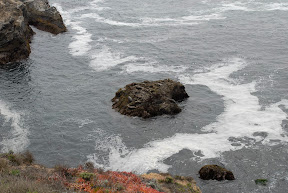
Today we took a little drive down South, mostly to take in some of this new scenery, but we ended up at a place called Point Lobos. If they haven't filmed movies at this location, I don't know why. It is beautiful.

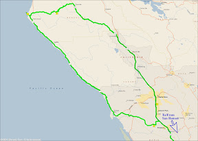
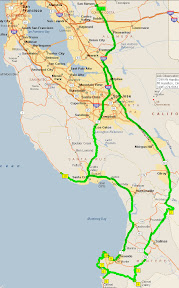
We headed South in the most efficient manner possible until we got about 90 miles from home. We then ventured off the beaten path to some twisty roads that included Laureles Grade Drive, a nice little stretch with 10% grades, up and down the pass. We even got further off the trail when we took a side trip off the pass onto a 1 lane road that my GPS said would be even more interesting but ended up dead ending. Oh well, it was still interesting.

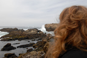
After the pass, we pretty much just found the Pacific Coast Highway (PCH) and headed about 5 miles south to Point Lobos. It takes $9 to get into the park but I could have spent a week there just watching the waves. It was a little cold and very windy so we didn't stay long, but take a look at my pics to see some of the amazing scenery.

When we left Point Lobos, I had noticed a road called 17 Mile Drive that looked interesting. Well, it is so interesting that the residents have decided that they can charge a $10 toll just for driving through. It's pretty worth it though, at least if you are just visiting. We paid the man and drove along the shaded road with the Pacific Ocean on our Left and amazing houses and golf courses like Pebble Beach, Cypress Point and Spyglass Hill along with some less notables as well. It was a great drive. Brenda thinks that this is where Clint Eastwood probably lives but we didn't see him jogging so we don't know.

After the 17 Mile Drive, we just returned to the PCH and headed homeward. We got pretty far along and heard that our planned route was suffering from a Semi accident earlier that day on the bridge that we planned to use to cross the San Francisco Bay. We backtracked about 10 miles and took a more direct route home having had a great drive.

If you look closely at the map you will see a little box about midway down on the right that says "Lick Observatory" on Mount Hamilton. That's where I am headed Tuesday.

oVo

Thursday, March 27, 2008

A little Catch-up


Ever since coming home from Thailand in October last year, I have let this Blog sit idle. There are a few reasons for that I guess, but none of them are because we have quit doing fun stuff. Let's see... I went diving in Honduras in October 2007, and took a great trip to Big Bend National Park shortly thereafter. We got a little tied up trying to find a place to live in San Ramon, CA while maintaining our place in Texas, but even that was adventurous in the "something different" sense of things. One reason I like blogging is because from time to time, I review the posts here and recapture some of the fun I had on these trips. And that's why I am going to pick this blog up again and keep it pretty current.

Since we now have a foothold in the far west of the US, we are using it to great advantage. Last weekend was functionally our first in CA. We have been here a few other weekends, but those days were consumed with apartment hunting or moving chores. But this past weekend we ran off from our remote base here and hit the trail to Yosemite National Park. What an amazing place. Even the drive there and back is amazing. We went out on Hwy 120 and came back on Hwy 140. Hwy 140 follows the Merced River all the way down the mountain so it is just spectacular.

Yosemite itself is pretty crowded, we thought we were rushing the season a bit since there is still snow in the higher elevations, but even this early the accessible parts of the park are packed. But we were able to basically drive up to Yosemite Falls and then take a couple of short hikes to Mirror Lake and Columbia Rock. Not back country hiking by any means. The trail to Mirror Lake is paved (for crying out loud) but the trail to Columbia Rock is far more severe.

Columbia Rock is only 1 mile from Yosemite Lodge where we stayed, but it is also 1000 ft higher in elevation. That is a average grade of 34% and that can wear on your legs. Still it was a great walk and left me wanting more. I came home and started looking for a good back country hike for when the snow melts.

We have other trips planned and we are looking forward to seeing this different part of our country. I'll keep you posted.

oVo

Tuesday, September 18, 2007

Koh Losin


HA HA HA HA HA!!!!

That's about all I can say about Koh Losin. It is an island for sure, but not much of one. It is about 100 square meters in area (small) and maybe 3 meters above sea level at its maximum height at low tide. What a place. But thanks to it's location 100 Km from the nearest land, it boasts plenty of clear water and we were treated to 30+ meters visibility on our trip. Great water indeed.

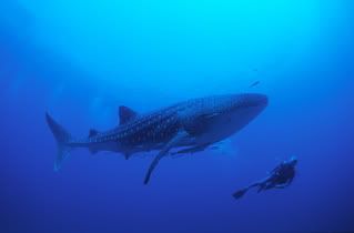
We were all hoping to see sights like the pic here, but none of the big animals felt like coming around the day we were there. Still, it was a great dive.

I had some "not unusual for me" sinus problem during this trip. I picked up a minor cold a few days before we left. As a result, I was unable to clear my ears properly and the text books all say that when that happens, you should do the smart thing and just stay on the boat, or better yet, stay home. But I had been looking forward to this trip for two months, and the visibility was so good, I figured I could stay at a comfortable 5 meters depth if I needed to and still see alot of what was there to see. It turns out I was right on the vis issue, but by descending slowly, I was also able to reach the same depth as my dive group and see the sites up close. It just took a little while longer and I had to be more careful than usual.

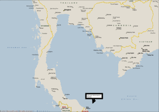
To get to Koh Losin from Bangkok, we flew South into Hat Yai, and drove an hour or so to Songkla, TH to pick up the boat. The boat cruised about 9 hours through the night and into the morning arriving at Koh Losin at 8:30 AM Saturday. The tiny Koh Losin is approx 62 miles (100 Km) East of Naritiwat, TH. The island houses a small light standard to warn off ships.

I was very pleased when I entered the water and put my face down to clearly see the 26-28 meter bottom from the surface. We spent the day in this area and planned to make a night dive at the nearby Losin Pinnacle, but a squall blew in and cancelled those plans, so we just relaxed on the boat and cruised toward our dive site for the next day.

Overnight we steamed to a large bay near Naritiwat, TH. Naritiwat has been plagued in the past few years by violence in the Muslim community. We stayed well offshore and in a fleet of 4 dive boats, presumably for safety. In the morning we made a quick trip south about 15 minutes to Lopi, a 24 meter site with poor vis and moderate current. We saw lots of small life including a resting lion fish and several large parrot fish. During our efforts to photograph the life, our dive group swam out of visibility so my dive buddy and I just kept poking around on our own. Most of the group got stung by small jellies on this dive, including me. No big deal. One more thing to say I've done I guess.

The Second dive of Sunday was the most enjoyable for me. We moved toward shore just a few dozen meters to an island larger than Koh Losin, but not named. At this site there was little current and lots (LOTS) of life from small to medium sized. We found a beautiful Blue spotted ray at this site, along with the Nalopeon Wrasse, a cool nudibranch and some bigger fish. This was my favorite dive of the trip.

The Third dive of Sunday was a couple of hours back to the Northwest at "Train Bogey" a 28 meter site made up of about 9 rail cars sunk there in 2001. My dive buddy split off on his own causing me some concern as I was still having problems descending as fast at the rest of the group and by the time I got to the dive depth, I could not find him. I spent most of this dive looking for my buddy, but finaly decided that he must have had camera problems and returned to the boat becaues he had told me that he did that anytime his camera enclosure showed signs of water intrusion. I was not right, but my buddy was OK and had just decided to make his own dive instead of complying with normal buddy protocol. As for myself, I was still plenty safe as I maintained close contact with the larger group so the only real risk was to my buddy and he brought it on himself. I guess all is well that ends well.

Visibility was not good on this dive, but I could clearly see that the site had plenty of potential if you could get there on a day when vis was good. Nine rail cars sunk to the sea floor provides plenty of cool places for sealife to gather and thrive.

Koh Losin is a good trip, but for my money I would go back to Koh Tao instead of taking this airplane/bus/boat trip. I guess if we had seen some whale sharks, my opinion might be different.

oVo

Thursday, September 13, 2007

Koh Losin - Pre-trip report


My Koh Losin dive trip is almost here. This will be my second "Live Aboard" dive trip, which is where you go out on a boat and just stay on board for a day or two or maybe longer. On Live-aboads you can dive more remote sites where hopefully the ecological pressure brought by divers is less, and you can (again hopefully) see stuff that is not impacted so much by us air breathers.

Koh Losin is so remote that it is only accessible by live-aboard trip. It is about 100 Km from the nearest land, which is Narawhitwat, Thailand. Narawhitwit is in the far South of Thailand, almost to Malasia, and Koh Losin is 62 miles East of that. It is on the border of the Gulf of Thailand and the Deeper South China Sea and there are no other land masses around.

The big hope for everyone diving Koh Losin is that they will see some of the Pelagic visitors that frequent the Island. I had to look up the word Pelagic, so I see no reason to tell you what it means in this Blog. Just do a websearch for yourself and get back to me.

I am hoping to see some of the "Bigs" that come around the island, but even if I don't this will be my Southernmost dive so far. I have been farther South, having crossed the Equator during my Naval career, but I honestly can't tell you what that looks like. Remember, I was in submarines.

I will leave for my trip tomorrow afternoon (Friday), and I will return Monday having made at least 7 dives including one more night dive.

Tuesday I get to pack up a few things and then Wednesday morning I head for the US for a visit. It will be a quick few days so I may not get to post any pics for a little while, but I hope that will be made up for by my ability to visit some of you while I am home.

oVo

Wednesday, August 29, 2007

Meeting People

Well today was more interesting than normal. I got bored sitting around the house so at around 10:30 in the morning I logged on to the internet and looked for a good movie to go see. I found one showing at 11:15 so I headed out and arrived at the theater in plenty of time. Actually I arrived at 11:13, but I know that the movies here show a half hour of previews, advertisements and a mandatory tribute to the king before each show so I had plenty of time.

I went to the box office to buy my ticket and was informed that the 11:15 showing had been cancelled today. The next showing was at 1:45 so I walked over to the MBK mall to have lunch and kill some time "people watching." MBK is one of the more interesting malls in Bangkok because it has a huge mix of small shops and almost everything you can think of is somewhere in the mall. It is also on the less expensive end of the shopping spectrum in Bangkok so it attracts all sorts of people from Thais to farang looking for good deals.

After lunch, I walked one of the six or so floors, not moving fast, just poking around and seeing what there was to see. After an hour or so, I decided to take a seat in one of the common areas to rest a bit and still be able to see the humanity flow past. After five minutes or so, a pretty, young Thai girl sat down next to me and ate meatballs on a stick, dipping each bite in a plastic bag of hot sauce for extra flavor. When she sat down, I turned and nodded. She smiled and nodded back. At that time, I didn’t notice the tattoo on the upper part of her breast, visible thanks to her low cut tee shirt. Do you see where this is going? I did not.

She finished her lunch and after a few more minutes she got my attention by saying “Hello.” I turned and greeted her and she continued with her thought. She said “You go home with me?” I only know that she said that because in what was likely a fairly surprised tone of voice I said “Excuse me?” And she repeated herself “You go home with me?” with a big smile.

I thanked my new friend but declined her very hospitable offer. I guess I must have looked homeless or something. Such a generous young lady.

A little while passed, and my potential new roommate got my attention again with her tried and true method of saying “Hello” and once again I turned, not sure exactly what to expect next. She said “Hello” again followed immediately by “Goodbye” with that same friendly smile on her face before rising and walking down the mall in search of her next friend. Who says it is hard to meet people in a strange land?

I watched her a bit as she walked away toward the escalator and as she turned to go down a floor, she looked up with the biggest smile yet and waved goodbye. Yup, some of these Thai folks sure are friendly.

oVo

Saturday, August 25, 2007

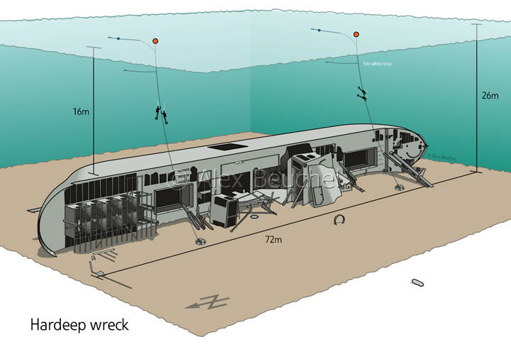
The Wreck of the Suddahadib (The Hardeep)

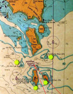
We took a little two dive day trip to Sattahip today. Sattahip is on the Gulf of Thailand South and East of Pattaya, which is South and East of Bangkok. It takes about three hours to drive to the pier and than another hour aboard the Marlin to reach the dive site.

The Gulf of Thailand was more calm than I have seen it so far. That should translate into good diving with no current and excellent Vis(ability) but it didn't. When we reached the site, another dive boat was already tied up to the permanent bouy so we had to enter the water on the fly. Our boat drove by the bouy and we just jumped. Sort of like Marines do I guess.

Once in the water, the current took us and took us hard. We fought to reach the bouy, which had an anchor line we could follow down to the wreck. By the time I reached the bouy, and began to "down climb" the anchor line into a zero visability green soup, I knew the bottom was 26 meters (85 ft) down and I could see no reason to continue this dive. Diving in poor vis is bad enough, but add a multi-knot current to it and it just seems like work. I called my dive (that means I returned to the boat) without ever going below 15 feet in depth.

My team (4 other intrepid divers) made it varying distances into the void and stayed down between 5 and 15 minutes. Not a great dive by any standard. When were all back aboard the Marlin, we headed to a calmer spot, protected by an island and featuring a small, but interesting reef (there are no un-interesting reefs.)

I "entered" and enjoyed a pleasant and easy dive with some fellow beginners and re-surfaced having had a wonderful, and not exciting dive. Not-exciting is a good thing for a dive since "exciting" usually means something went wrong and maybe you sort of .... drowned. (just kidding Mom)

When I surface and re-boarded the Marlin, my dive instructor SaN, asked me how the dive went as he always does, and I reported favorably. He then told me that he and "The Team" were going to dive the wreck again and he thought I should come. I readily agreed knowing that I could always call my dive again if I didn't like the way things were going, and I fully expected to call my dive because I could see a rip in the surface waters near the nearby wreck.

We motored over to the wreck site and bailed off of the security of the Marlin once again. I swam over toward the bouy having to look up every few seconds because the current was still strong and was taking me North back to Sattahip just about as fast as I could swim South toward the bouy.

I reached the bouy and emptied my Bouyancy Contol Device to begin my descent. I down-climbed the anchor line hand over hand for 10 meters (33 feet) in a current that had to be 3 - 4 knots. If you think that is slow.... think again. Hanging on to the anchor line I figured I now know what a flag in a stiff breeze feels like.


But at about 35 feet, the Vis started clearing up and the current diminished. At 60 feet I could see the bottom (at 85 ft) and the wreck was in full view. It was a massive feature rising from the sandy bottom in rusted steel beams and corroded metal plates.

We tucked into the "shadow" of the wreck and began to probe "foreward" toward the bow. As we reached the bow SaN poked his head out from the protection of the old ship and immediatly signaled that we should turn and go toward the stern. The current was still strong, even on the bottom, but the wreck was shielding us from it.

We turned and headed aft along the 90 degree listed deck of the wreck. About a third of the way aft, a large opening in the deck made itself too inviting to resist and we all entered the bowels of the ship. Divers call this an "overhead environment" because if something happens and you need to surface quickly, you must first reach an exit or else you will just hit your head on the overhead. I have never entered an overhead before, and I didn't expect to enjoy it. I am a BIG guy at 6'5 and 210 lbs and small spaces in places where there is no air to breath do not appeal to me. But I went in and I must say it was WAY cool. I really enjoyed it, but honestly it was not crowded and the 65 years beneath the waves had rusted away the deck (hull) enough that there was plenty of light so it was not at all what I expected. Hmmmm I wonder what cave diving might be like?

We fiddled and piddled until I was nearly out of air in my tank. At that point I headed back toward the bouy anchor line and began to up-climb the line toward the surface, once again flapping in the current like a cartoon character.

We all had such a good dive, but only after we were able to descend beyond the first 33 feet of turbulent, turbid waters and into the relative calm afforded by the protection of the old wreck. I am so glad I gave this dive site a second effort. Hmmm I wonder if there is a life lesson in that?

If you want to see more about the Hardeep (Suddahidib), go here.

One of our team had a camera, and he may send me pics of me around the Hardeep. If so I will update this post to include at least one. Til then....


oVo

Friday, August 17, 2007

Brenda Working

jumpcut movie:Brenda WorkingAnyone who knows Brenda, knows that she works too hard. But from time to time, she can surprise you with a team building outing to a world class resort or...... a bowling alley. Click on the pic here, and then click the arrow that looks like a "play button" on your VCR. Be sure to watch until her ball hits the pins.... You may be here awhile.

Enjoy

oVo

Monday, August 13, 2007

Practice Dive - 11 Aug 2007


Some new friends took me to Pattaya for a quick training session in the milky green waters just off the mainland. Pattaya is not great diving, but it is close, only a couple of hours drive, and it is reasonably predictable. Sort of like McDonalds, you are not going to have a great meal there but you can count on it being acceptable most of the time.

My training is yielding benefits. I am more and more comfortable in the water so I am more relaxed. I am breathing better and using less air, although I have a long way to go before I am proficient at air usage.

I am also controlling my bouyancy better and I think I am about ready to drop a couple of pounds off my kit. I have been diving with a 6 lb backplate (the thing my tanks strap to) and a 6 lb lead weight on the tank adaptor, and another 2 lb weight on the upper tank strap for a total of 14 lbs of weight on the kit. All this weight is necessary to overcome the bouyancy of my wetsuit and my body, but also to compensate for poor breathing practices that I have been trying to eliminate. I think I have just about conquered the worst part of my breathing. We'll see next trip when I try to reduce my weight to 12 lb.

The highlight of this trip was the scooter ride. One of the group has two Diver Propulsion Vehicles (DPV or Scooter.) He broke them out and let us all try them. Some fun. Unfortunatly, the visability was very poor Saturday so this pic is not of our trip, but is of the owner of the DPVs. Jim, the owner also has a website that has some dive video of his trips if you want to see some of the stuff we see on our dives go to Jim's Web Site


oVo

Monday, August 06, 2007

Diving - Koh Tao: August 2007


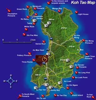
What a great dive trip! Koh Tao is pretty isolated in the Gulf of Thailand but the island and it's surrounds has over 25 named dive sites and we were lucky enough to hit one of the best on an exceptional day.

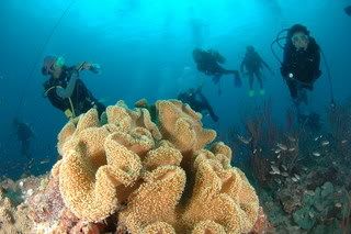
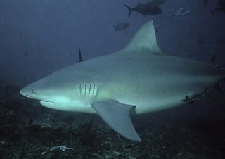
Chumporn Pinacle is a site that has a beautiful reef starting at about 15 meters and having a vertical drop off to 40 meters. All along the vertical drop are different species of sea life. And patrolling the outskirts for careless animals (and/or divers) on the day we were there were some ominous gliding shadows that were clearly identifiable as Bull Sharks. I felt pretty secure because the sharks generally stayed below 30 meters, and usually at least 15 meters away from the reef. Our dive group was 20 divers and there were also three other dive boats at the site the day we were there, so I was counting on being only one of maybe 60 potential meals for these guys too. As it turned out, we all returned to the boat with our fingers and toes in tact and having seen some amazing coral, anemones, a turtle and fish of all types. Such a good trip.

All in all we made 7 dives in two days at sites that went to 40 meters, and a few places that only went to 10 - 20 meters. We had one night dive but the site was apparently not a night spot because we didn't see much activity. Most of us on that dive were doing some sort of certification that required a night dive using only a compass to swim away from the instructor and back to her without getting lost. Most of us made it!

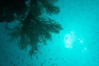
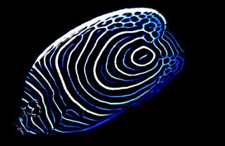
I don't have an underwater enclosure for my camera, but I am lucky enough to have friends who take pictures and let me have copies. My "above the surface" pics can be found at http://perfectloop.vox.com/ if you would like to look around. The two exceptional pics shown here were taken by Kuhn Nat, a professional underwater photographer who generously let me have these pics just because I liked them so much.


Can't wait for the next trip.

oVo

Monday, July 23, 2007

Angkor Wat - Cambodia

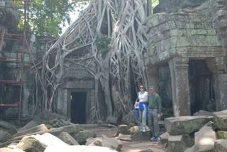
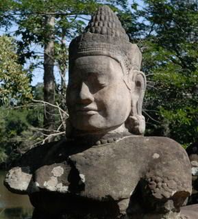
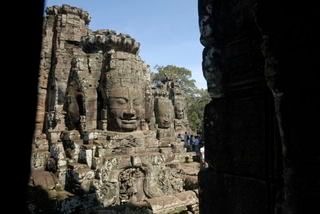
Angkor is an ancient city in Cambodia. Angkor Wat means "The city that is a Temple" or something like that. The kings of this day had a great deal going. They were gods (of course) and they told their subjects that anyone who helped build the temple, or supplied materials, or supplied food for the people building were assured of going to heaven upon leaving this life. Well, like all pyramid schemes (pun intended) that worked for awhile but eventually everyone who was interested in gaining their spot in heaven had been pretty much worked out. So the free labor scheme turned into true multi-level marketing when the king proclaimed that there are 36 levels to heaven, and only those who gave their all would gain the highest levels. One king used this tactic to build a new temple every 5 years.

These ruins are 800 - 1100 years old. If you do a web search on the 7 wonders of the ancient world, you will see that Angkor Wat usually comes in at number 9 or 10, just out of the money. Not bad though considering that of the original 7 only 1 survives until now and Angkor is still going strong.

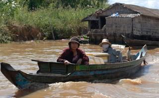
Some of these temples took only 5 years or less to build but the grand dame of the region took over 35 years to erect. It is still in the best shape of all the ruins despite being the oldest. Over the years, France, Japan and other countries have undertaken both restoration and humanitarian projects in this war ravaged region. We saw numerous water wells spotting the country-side, each with a sign giving credit to the country or Non-profit agency that drilled it. The ones we saw were heavily utilized too, with activities from simply drawing water to taking a bath from a bucket right at the well. Bullet holes are also evident in the structures as Cambodia has generally been in a civil war for the last 1000 years only emerging from it around 1979 with the demise of Pol Pot and the Khmer Rouge.

As we drove through the North part of town, our guide told us that the people here in the North end of town are the business people and are generally in much better financial position than the farmers in the South. Hmmmm.... The homes we saw there on the “right side of the tracks” were predominantly grass huts varying in size from 8x10 to around 10x20. I figured that our guide, clearly one of the well off folks in this town has the potential to bring in about $5000 per year if he works 200 days a year.


Speaking of money, you don't need to exchange your money in Cambodia. Everyone eagerly accepts the good old American Greenback and can even make change in US$ as long as it doesn't require coinage. They price things for the American tourist too. Our guide says that the attitude when they see a tourist is "Hey, the Millionaires are here." And yes that is a quote. Most of the stuff you see is not worth half of what they ask, so they have signs everywhere claiming that all the items are made locally by orphans and land mine victims. Never mind the labels on the back that say made in Malaysia.

This was a good trip. It was hot, too hot but it was the slow season (did I mention that it was hot) so it wasn’t too crowded. In the busy season I can imagine not being able to get a picture at all without another tourist in the frame.

Before we left Bankok on this trip, we had asked the Thai people that we know if they had ever been to Cambodia. We were a little surprised when no one had ever been, but once we got there and learned the origin of the town that we stayed in we lost our surprise. Angkor is the ancient town, but Siam Reap is the modern town nearby. Siam means Thailand. Reap means Defeated. So the Cambodians named this little town for the point in time when the Khmer warriors defeated the Thai army and gained their independence from Siam. The Khmer speak glowingly of their fierce army and how they struck fear into the weaker Thai army. The Thais on the other hand giggle at our reports of the dirt roads and primitive living conditions of their neighbors. I’m not sure anyone has won any significant battles in this struggle.

oVo