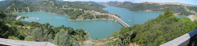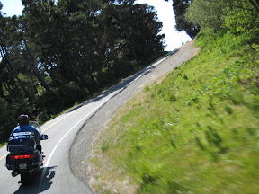
I had several items on my list of fun things to do this week. I was going on a motorcycle ride Monday but the weather turned even colder than normal with night time temps in the 30s and the days warming up slowly. To top it off, the guy I was hoping to ride with had a family emergency and wasn't able to join me so I just filed the map and will do it some other time.
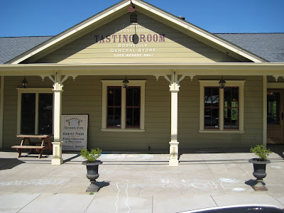
I was also going to take the commuter train into San Francisco to scout for a weekend trip that Brenda and I were planning to take this Saturday. But, although the weather has warmed back up the forecast for the weekend looks cold and windy in the city so we are holding off on the Saturday trip too.
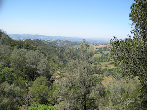
But the one thing that I had not planned to do, but that has been on my list for some time is to take a walk up in Mt Diablo State Park. Mt. Diablo is the biggest thing around here rising 3,849 ft and offering views of things as far away as the Golden Gate Bridge on clear days. One web site says that Mt Diablo provides views of more geographic area than any other peak except Mt Kilimanjaro. Not sure I believe that but there are some nice views. Check it yourself though at
this site.
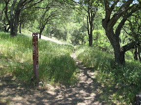
Anyway, last night I pulled out my trail map that I bought a few months back and with the help of the web found a trail route that I thought fit my needs for today. It was a six mile loop with a 1000 ft elevation gain and is rated "strenuous" or "moderate" depending on the website you find it on. For me, it took three hours and I rested about three times during the steepest portions of the climbing sections. Moderate is probably about right.
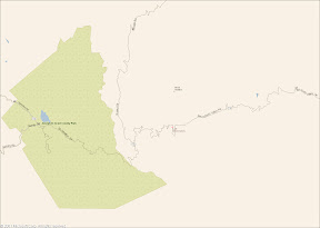
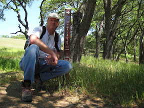
I picked up the trailhead at Macedo Ranch which has a ranger station at it along with some picnic tables, drinking water and water for horses. The state charges $3 on the honor system to park in their gravel lot so after stuffing an envelope I strapped on my day pack and headed out.
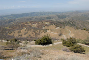
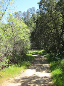
I was a little disappointed initially since the "trail" was actually a dirt road that they use for fire abatement during the dry season. It turns out that most of the trails here are like that. But at the furthest point in my walk today I took a hard right hand turn onto "Secret Trail" and was rewarded with a foot path that gained elevation from 1175 to 1465 ft in about a mile and joins BBQ Terrace Rd with Wall Point Rd.
My walk today provided plenty of rewards besides the clean air and exercise. I saw lots of scenery and plants that I am not used to seeing. I listened to wild turkeys from just over the next ridge and was stopped in my tracks by bees buzzing so loudly that they commanded attention. I even heard that "Eagle screech" sound that all the TV shows use when they want you to know that you are viewing a wilderness program.
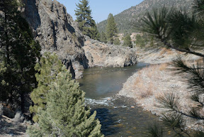
Mt. Diablo is far from wilderness and does not even allow back country camping. Normally there is no where to camp in the back country because of the scarcity of water, but today I made three stream crossings and enjoyed touching the icy snow runoff each time.
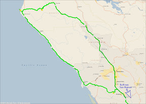
My route today started at Macedo Ranch and proceeded North by Northeast about 0.87 miles along Wall Point Rd to Dusty Rd, which branches due North (left.) Dusty Rd descends 260 ft in a half mile and intersects with Stage Rd before merging into BBQ
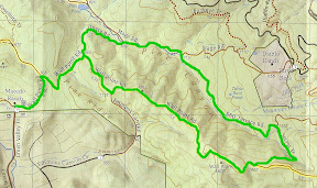
Terrace Rd in another 0.45 miles and after ascending a mere 80 ft before splitting from Stage Rd for good. At this point you are at 715 ft with a steady climb to 1175 facing you over the next mile to the intersection of Secret Path. Turning Right (SE) on Secret Path continues the climb over the next mile to 1465 ft where you rejoin Wall Point Rd and climb the remaining 135 ft in just a quarter mile or so before starting your descent with the sheer drop to your left. Look closely and you may spot some interesting erosion patterns in some of the rocks jutting up from the canyon floor 500 feet below. The descent is easy as long as your knees are good. I stopped a few times to rub my worn out hinges. I guess my basketball injury from earlier in the year is not quite healed yet. One and three quarter miles later you intersect Dusty Rd again, only this time you turn hard left (SW) to get back to the trailhead having seen wonderful vistas and no telling what else.
With 20,000 acres and over 100 miles of trails I suspect that Mt Diablo has not seen the last of me... …or me of it.
oVo
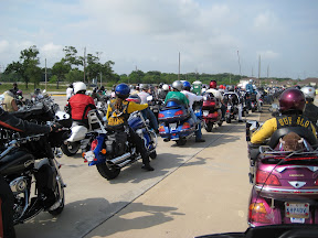 Once a year a bunch of motorcycle riders in the Houston area get together and take a little ride to raise money for medical research centering on brain tumors that occur in children. This event is called the "Ride for Kids" and it benefits the Pediatric Brain Tumor Foundation. (See links on right side bar)